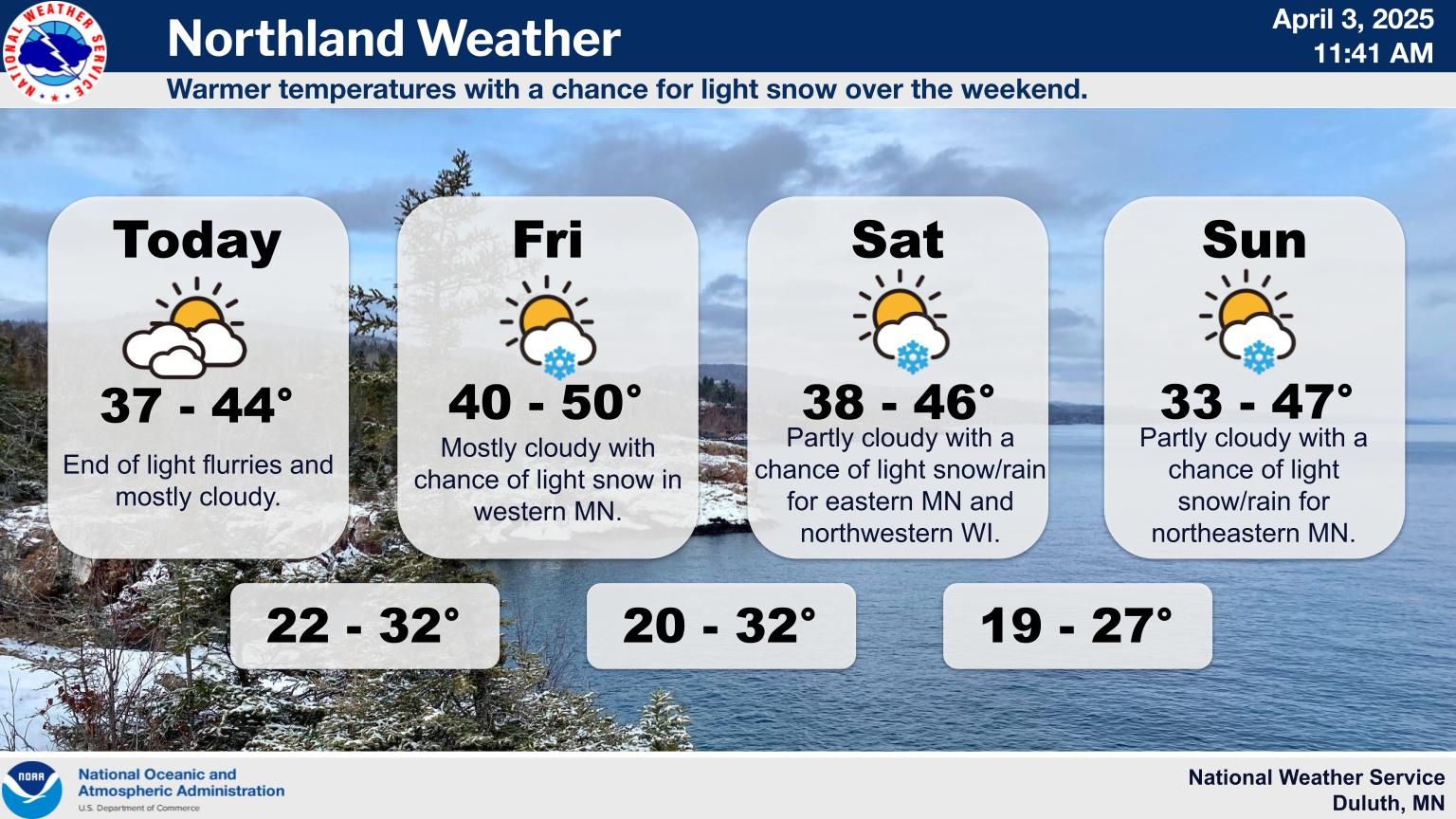
A few storms possible today
Jul 03, 2026 05:04AM ● By Content Editor
From the National Weather Service in Duluth - July 3, 2026
Persistent chances for showers and thunderstorms continue. Today, isolated strong to severe thunderstorms are possible in the afternoon and evening, possibly overnight into Saturday morning. The primary hazard from any severe storm would be damaging wind gusts up to 60 mph. On Saturday, no severe storms are expected at this time, but area-wide scattered thunderstorms are possible. Make sure you have a way to receive warnings and a way to find a indoor shelter this holiday weekend.
![]()
Persistent chances for showers and thunderstorms continue. Today, isolated strong to severe thunderstorms are possible in the afternoon and evening, possibly overnight into Saturday morning. The primary hazard from any severe storm would be damaging wind gusts up to 60 mph. On Saturday, no severe storms are expected at this time, but area-wide scattered thunderstorms are possible. Make sure you have a way to receive warnings and a way to find a indoor shelter this holiday weekend.
Heading into the holiday weekend, we are tracking a few forecast changes for the Northland. Expect slightly cooler temperatures for Saturday and Sunday before the heat and humidity return next week. Please stay weather-aware today and tonight, as scattered showers and thunderstorms persist. There is an isolated severe storm threat for the Brainerd Lakes, the I-35 corridor, and portions of NW Wisconsin. Looking ahead to Independence Day tomorrow, a northeasterly wind off Lake Superior will bring considerably cooler conditions to the North Shore and Twin Ports, along with an increased rip current risk for the beaches of Duluth and Superior. Have a safe and happy holiday weekend!
For additional weather details, go to https://www.weather.gov/dlh/weatherstory

