Northland 5 day forecast
May 06, 2024 06:50AM ● By Content Editor
From the National Weather Service • Duluth • May 6, 2024
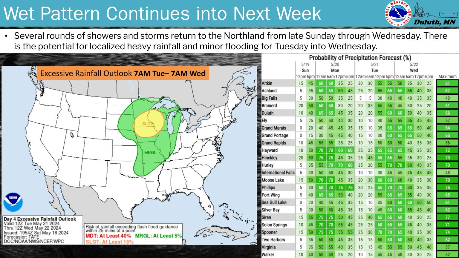
This week will continue to be characterized by chances of rain. The best chance is late Monday through Tuesday, with the heaviest rain and chance of thunderstorms, along with strong winds. Temperatures remain fairly seasonable.
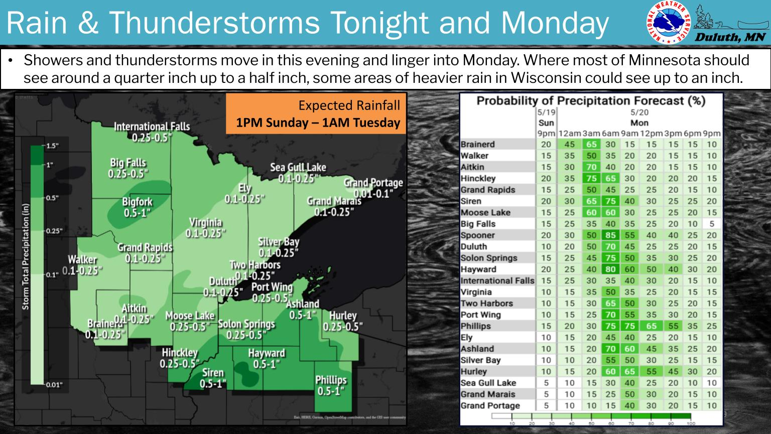
The next round of rainfall arrives late Monday night into early Tuesday morning. There is a 20% chance of non-severe thunderstorms as well in this time period for the Brainerd Lakes and east-central Minnesota. The heaviest rainfall is expected Tuesday morning and again later Tuesday afternoon and evening. An isolated severe thunderstorm producing large hail around 1" in diameter cannot be ruled out late Tuesday afternoon to mid-evening in inland northwest Wisconsin.
There is a 5-10% chance of an isolated severe thunderstorm to produce large hail around 1" in size from late afternoon to mid-evening on Tuesday in inland northwest Wisconsin. The best potential is in the southern parts of Burnett, Washburn, Sawyer and Price Counties in this time period. The rest of the Northland is much more likely to see general thunderstorms producing small hail and wind gusts around 40 mph.
