Severe storm threat Tuesday night
Jun 09, 2026 05:37AM ● By Content Editor
From the National Weather Service in Duluth - June 9, 2026
Chances for strong to severe storms arrive late tonight into early Wednesday morning, with the best severe potential in portions of north-central and northeast Minnesota. Potential storm hazards primarily include damaging wind gusts up to 70 mph, but large hail, locally heavy rainfall, and an isolated tornado are also possible. Monitor the forecast for the latest updates.
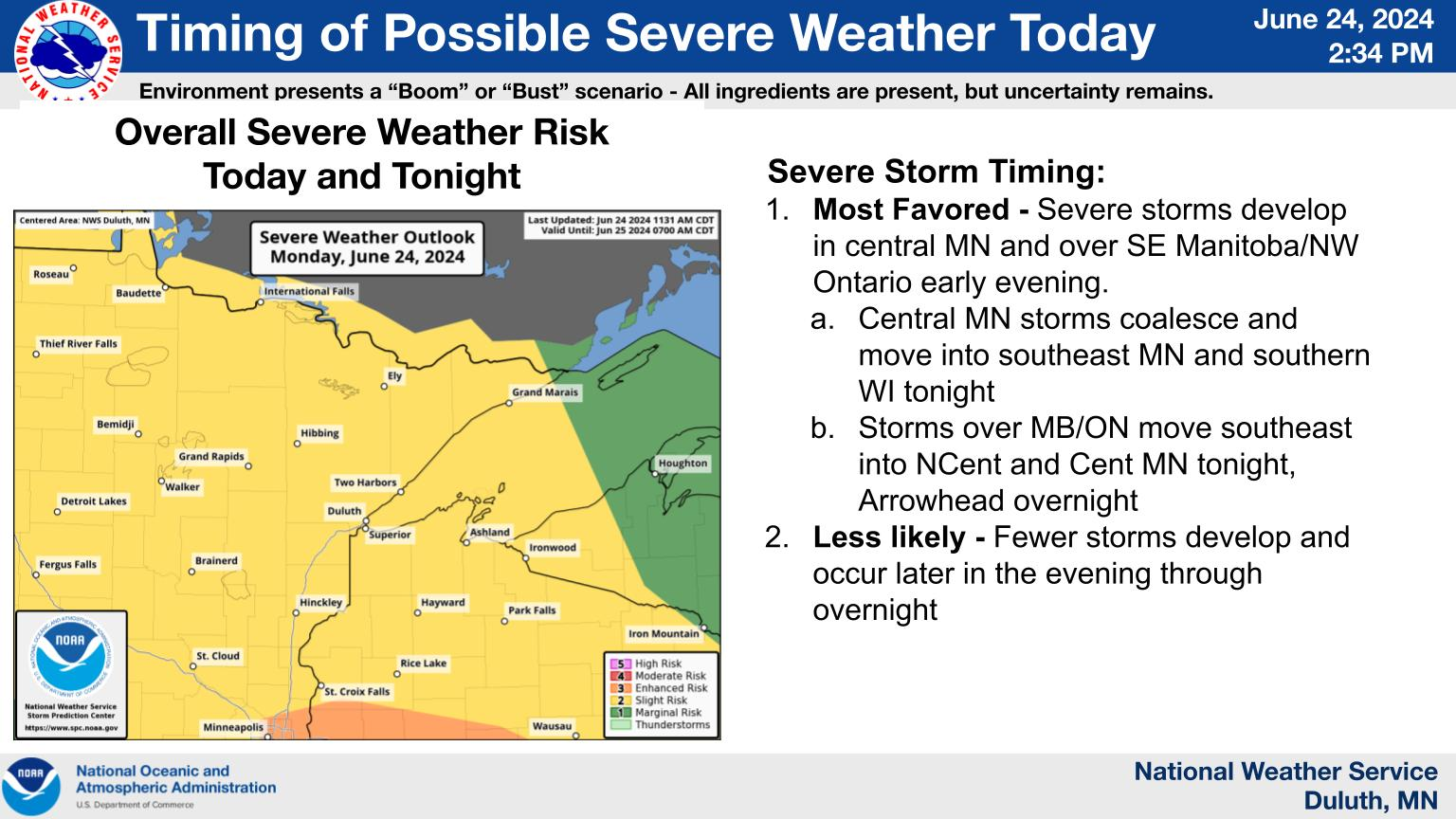
Scattered to numerous severe thunderstorms are possible Wednesday afternoon and evening for the entirety of the Northland. All storm hazards are possible, including damaging winds, large to very large hail, tornadoes, and heavy rainfall that could lead to localized flash flooding. Coverage and duration of morning showers and storms could impact the severe potential Wednesday afternoon and evening.
![]()
Chances for strong to severe storms arrive late tonight into early Wednesday morning, with the best severe potential in portions of north-central and northeast Minnesota. Potential storm hazards primarily include damaging wind gusts up to 70 mph, but large hail, locally heavy rainfall, and an isolated tornado are also possible. Monitor the forecast for the latest updates.
Scattered to numerous severe thunderstorms are possible Wednesday afternoon and evening for the entirety of the Northland. All storm hazards are possible, including damaging winds, large to very large hail, tornadoes, and heavy rainfall that could lead to localized flash flooding. Coverage and duration of morning showers and storms could impact the severe potential Wednesday afternoon and evening.
For additional weather details, go to https://www.weather.gov/dlh/weatherstory

