Monitoring potential for 'classic' winter storm track in Minnesota Monday-Tuesday
Dec 30, 2022 12:15PM ● By Content Editor
By Joe Nelson - Bring Me The News - December 30, 2022
It's looking likely that parts of Minnesota will be in for a big winter storm early next week, though it's still a bit too early for the National Weather Service to say where the heaviest snow will fall and whether rain or freezing rain will impact totals.
The NWS says the latest model guidance suggests that a strong low-pressure system will pass "somewhere over Iowa," which is a "classic track for winter storms here."
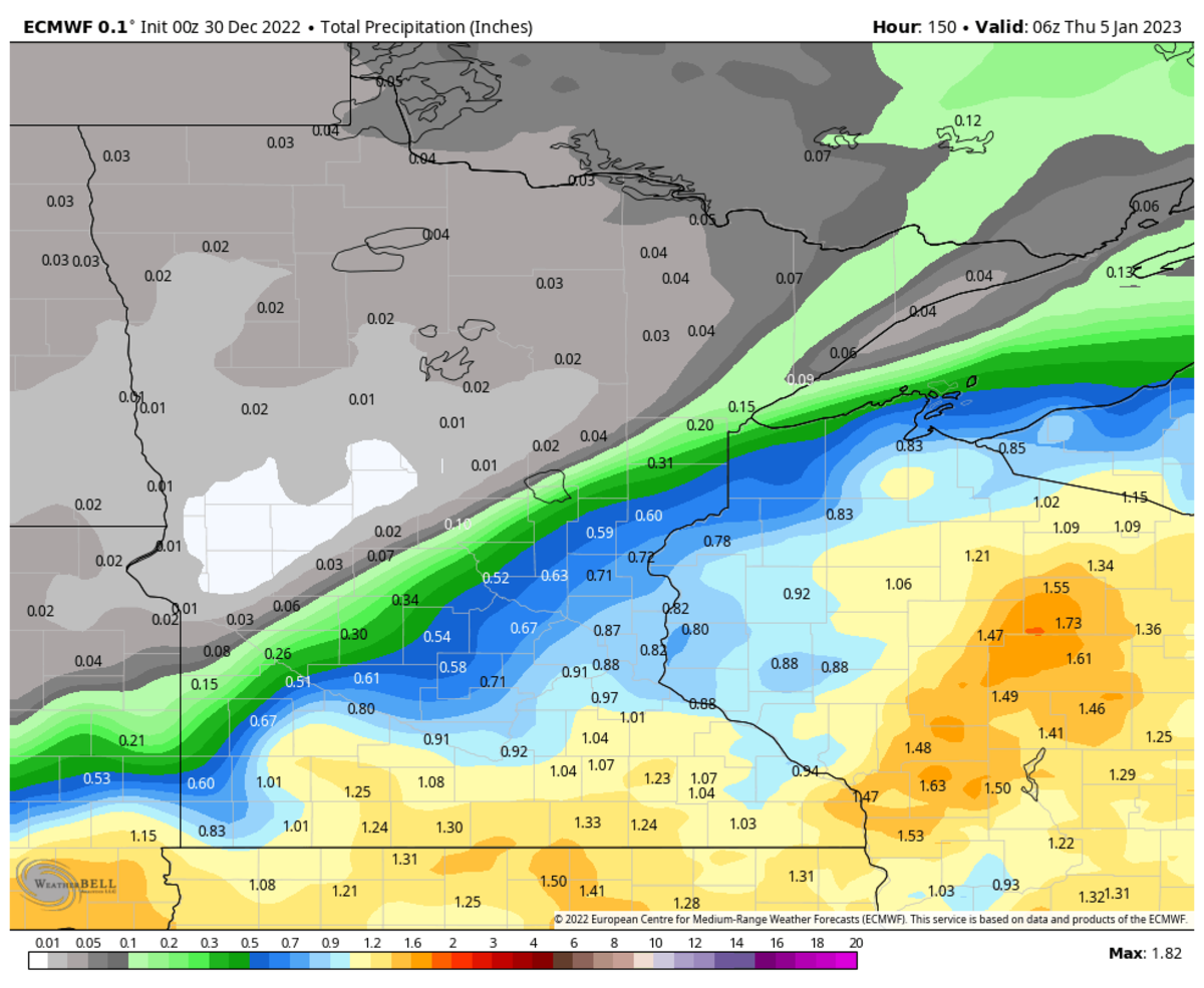
The biggest questions are what the storm track will be and if warm air will lead to rain cutting down on snow totals. Regardless of what falls from the sky – rain or snow – the system appears to be loaded with precipitation. The NWS says models are forecasting as much precipitation in this storm as what normally falls at MSP in all of January.
"Ensemble systems still show a wide spread, but there are some really impressive QPF amounts in many members for an early January system. This spread is still large and when taking in the three main ensemble systems the upper and lower quartiles at MSP are about 0.75" apart. The normal liquid precipitation accumulation in January at MSP is 0.89" so the spread is close to the monthly normal!"
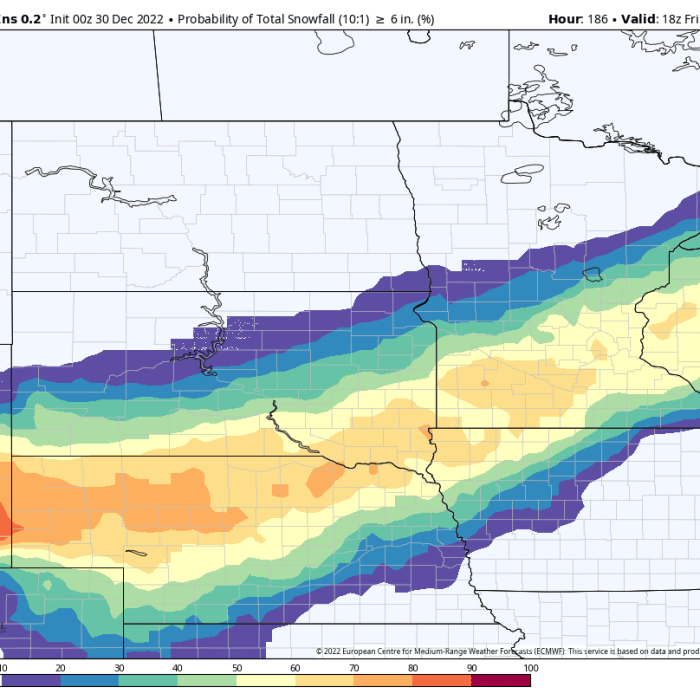
When you look at the three main ensembles (European, American, Canadian) you can see how the storm track could vary based on where all three are currently projecting a 50-50 chance for 6+ inches of snow. Clearly, the Twin Cities getting slammed with snow is NOT a guarantee.
WeatherBell
Let's look at how much precipitation the European, American and Canadian models are printing out. Again, these are all subject to change.
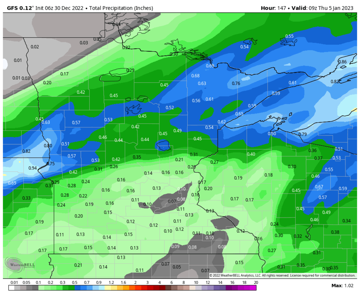
European: It's predicting 0.88 inches of liquid at MSP. If all of that fell as snow at a 12:1 ratio (12 inches of snow for 1 inch of liquid), it would be about 10 inches of snow. At a 10:1 ratio it would be 8-9 inches of snow. But those totals would drop if any of it falls as rain, freezing rain or a mix.
WeatherBell
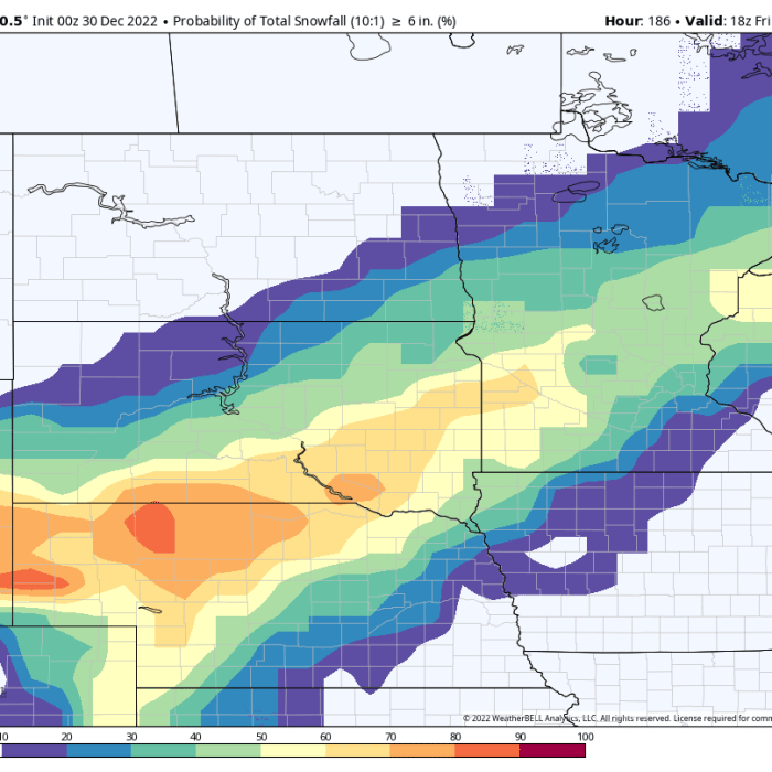
American: this model isn't printing out as much precipitation, which would lead to lower snow totals. The track is also further north, so the Twin Cities would get mostly rain.
WeatherBell
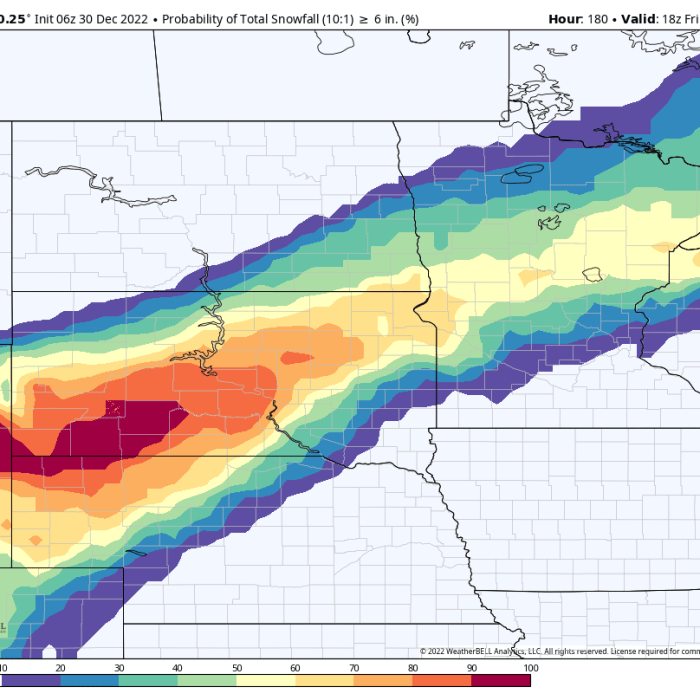
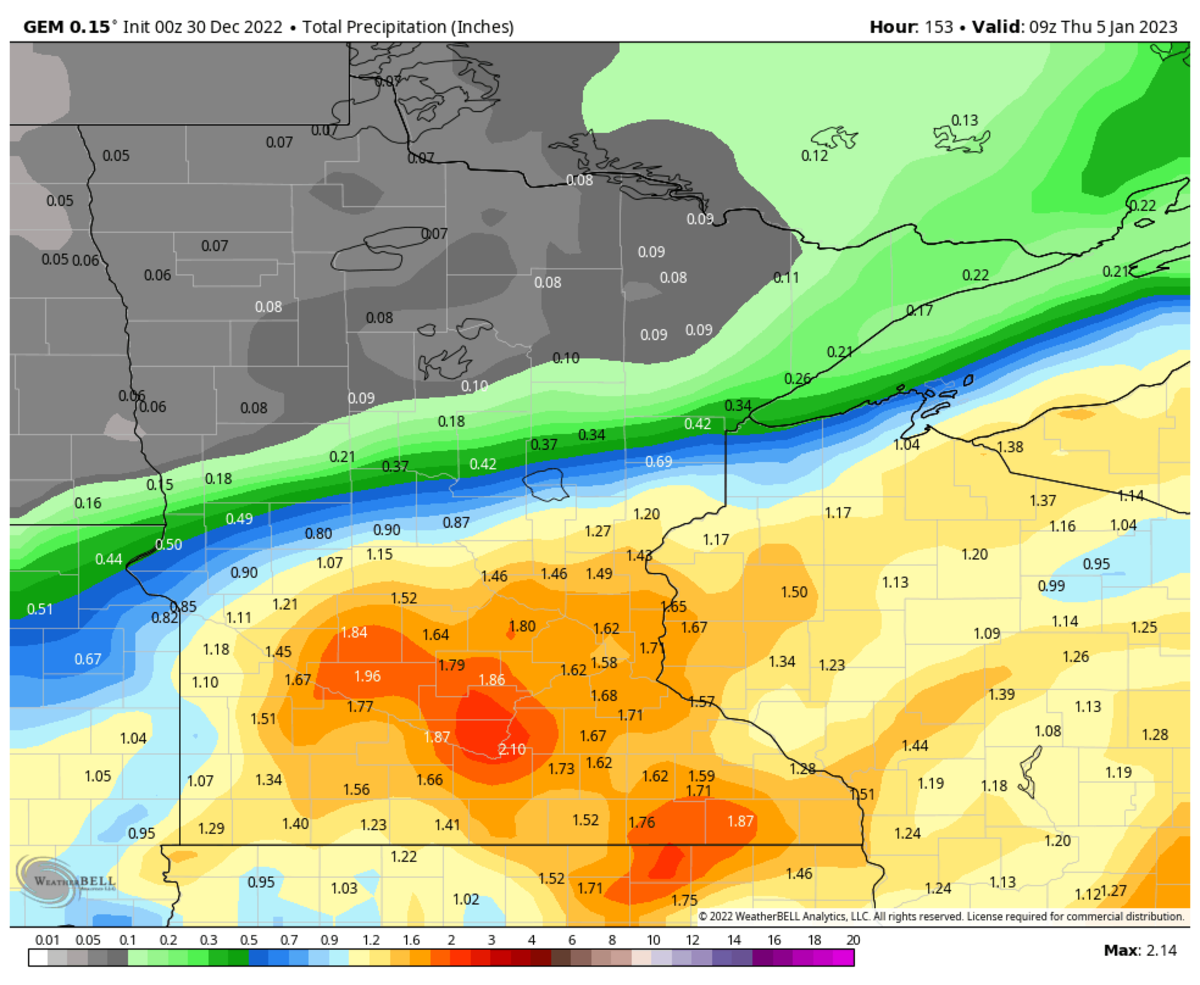
Canadian: this model is dumping extremely high precipitation totals in southern Minnesota. If this were to verify and fall as snow, we'd be talking about some big time snow amounts. But again, rain and freezing rain could change everything.
WeatherBell
We'll have more with meteorologist Sven Sundgaard later Friday, and we'll keep updating the storm track and forecast throughout the weekend.
To read this original story and more news, follow this link to the Bring Me The News website.
