What does an early first snowfall mean for Minnesota's winter?
Oct 18, 2022 09:56AM ● By Content Editor
By Sven Sundgaard - Bring Me The News - October 14, 2022
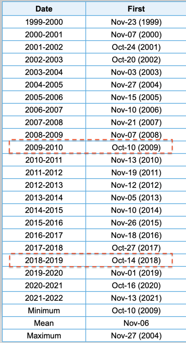
We got the first measurable snowfall out of the way and this year, it came early. On average, we see the first measurable snowfall (defined by 0.1 inches or more) in the first week of November. This year it came about three weeks early which puts it in the top 10% of early snowfalls. It’s only the third time it's happened this early since 2000.
Whenever anything winter-like happens early, it begs the question: What, if anything, does it mean about the upcoming winter?
Most of the time we can safely say it means absolutely nothing. That’s because our four seasons are pretty different in Minnesota with very different atmospheric patterns. In recent years, our winter pattern hasn't even established itself until well into December, so deciphering anything out of an October event is silly.
But, let’s take a gander anyway, shall we?
When we plot the date of the first snowfall versus the total seasonal snowfall the following winter we see basically no correlation. The yellow dashed line in the graph below represents the average annual snowfall, which historically is about 47 inches in the Twin Cities.
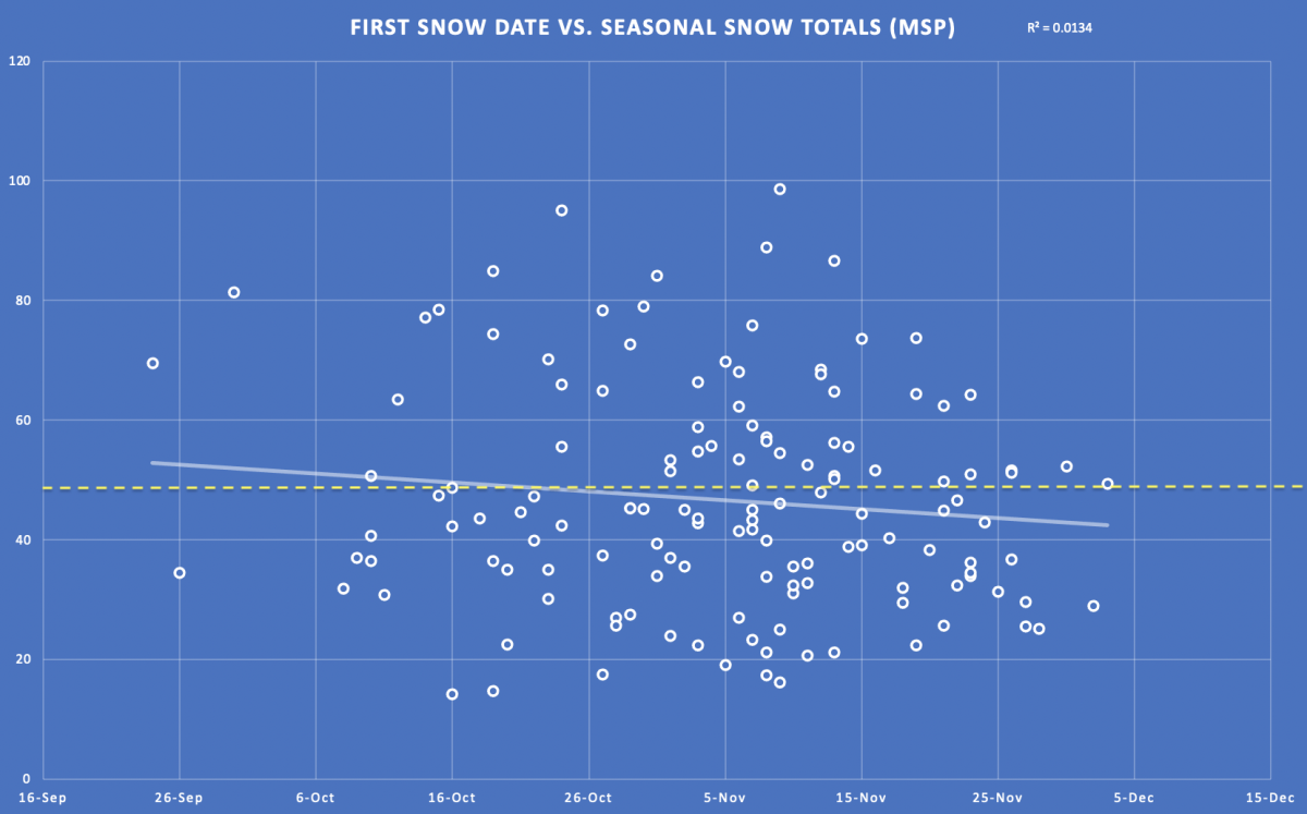
There is a subtle trend in slightly higher amounts the earlier the first snowfall comes and the opposite is true later but it’s not strong. In an ideal world, we’d want to see all the dots line up as close to the trend line as possible and we’d call that a good fit or correlation between date of the first snow and the total seasonal snowfall.
If we take a deeper dive and look at snowfalls that come particularly early, which I’ll define as those in the top 10% earliest (like this year), we see an even worse correlation. That's largely because there aren’t that many data points – only 14 years when the first measurable snow happened Oct. 16 or earlier.
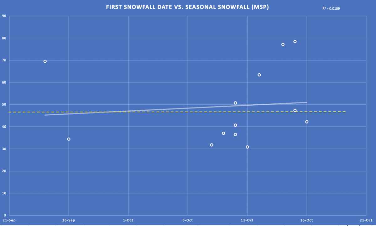
In 2018 the first snow at MSP was Oct. 14 and that winter saw 77.1 inches of snow.
In 2009 the first snow at MSP was Oct. 10 and that winter produced 40.7 inches.
In 2010 the first snow at MSP was Nov. 13 and that winter had 86.6 inches.
What about temperatures in years when we get an early snowfall?
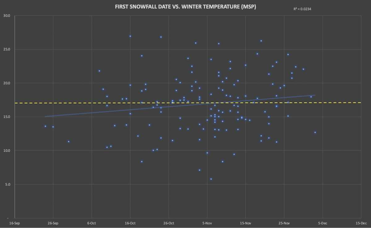
Again, it’s not a strong correlation, but it's double that of snowfalls. In general, there’s a subtle trend (which make sense) favoring slightly colder winters if the first snowfall comes early. Comparatively, there's a slight favorability for a milder winter if the first snow comes later than normal. However, once again, the data points are all over the place so it’s no slam dunk by any means.
If we dive deeper into the particularly early snowfalls, there’s more of a trend.
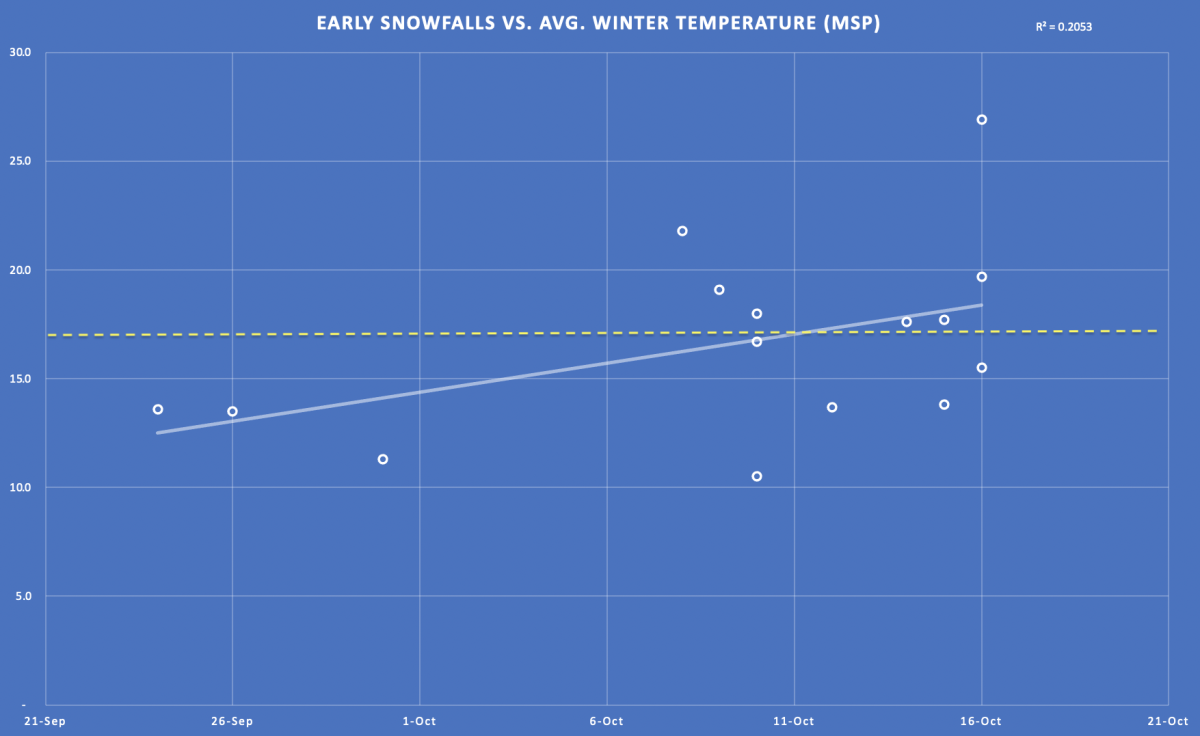
But, there’s only a trend to colder winters if the first snowfall comes REALLY early, like late September or the first week of October. Not mid-October, like this year.
Basically, our Oct. 14 first snow means pretty much nothing about the upcoming winter, not in terms of snowfall or temperatures. But if you’re curious, I ran the numbers to see what we come up with if the winter were determined solely by the date of the first snowfall and it was an accurate correlation (neither of which are true so this if pure fun!):
- Temperature: 18.2° (modern normal is 19.2°, historic average is 16.9°)
- Seasonal snowfall: 51 inches (modern normal is 52.3”, historical average is 46.6”)
Make your winter plans accordingly!
To read this original story and more news, follow this link to the Bring Me The News website.
