Duluth, Minn., August 25, 2023—The Superior National Forest (SNF) will be assisting Boise State personnel with a LiDAR (light detection and ranging) acquisition using a UAS (unmanned aircraft system) drone within the burned area perimeter of the 2021 Greenwood Fire. Operations are scheduled to occur next week, August 27–September 2, 2023.
The UAS, owned by Boise State, will fly at a low altitude, with SNF staff assisting with monitoring of the airspace, moving equipment, and keeping a line of sight with the UAS drone (which may include tree climbing).
Data CollectionUnmanned aircraft systems (UAS) can be used to collect multiple data types using different sensors. Imagery collected with adequate overlap can be processed with photogrammetry to create surface and terrain models. LiDAR outperforms photogrammetry for detailed ground mapping in vegetated areas.
LiDAR is an active sensor, meaning it emits its own energy. It captures three-dimensional information of the earth’s surface and can capture information beneath vegetation which makes it excellent for creating detailed terrain models or vegetation and canopy metrics.
Boise State is working with the Forest Service (SNF and the Northern Research Station) because of their knowledgeable background in assisting other national forests across the country with using UAS for forestry applications.
Data OutcomeThe LiDAR data collected within the Greenwood Fire perimeter will be processed to create a digital terrain model (DTM) of peatlands that were severely burned during the Greenwood Fire. That post-fire data will be compared with existing pre-fire LiDAR data to determine loss of peatland elevation from the wildfire. In 2022, SNF soils staff collected peatland soil cores across a range of peatland ecosystems and burn severities within the Greenwood Fire burn perimeter. Further laboratory analyses from those samples, along with measured losses in peatland elevation will allow Forest Service research scientists to estimate overall loss of carbon and other greenhouse gases from the peatlands after the wildfire.
Peatlands are the largest, natural, terrestrial carbon store: They store more carbon than all other vegetation types in the world combined. The SNF can be more proactive with forest management within and adjacent to these climate-sensitive ecosystems by understanding wildfire effects on peatlands.
Digital terrain models (DTMs) are elevation datasets that represent the ground elevation. Terrain models can be created from imagery in open or unforested environments or from LiDAR in all environments.
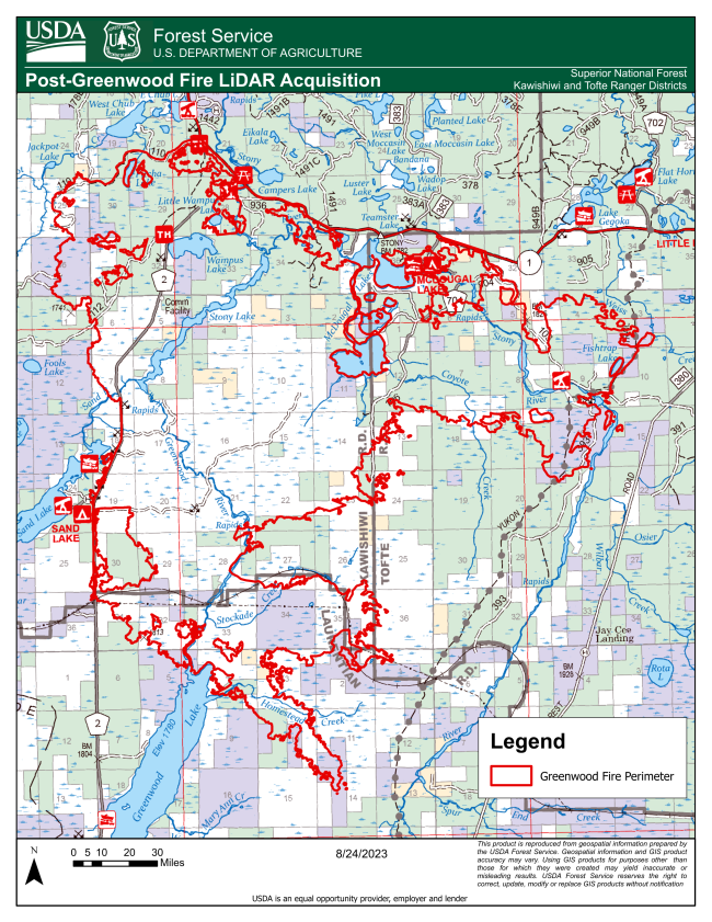
General Project Area Extent· North to State Highway 1 · South to Greenwood Lake · West to County Highway 2 · East to Stony River
|